See better, know more
Fully-automated seafloor intelligence for smarter maritime surveys
PlanBlue gives you a new layer of seafloor intelligence by uniquely fusing RGB, hyperspectral, and geospatial data, allowing you to see beyond what normal cameras, LiDAR, and sonar can detect.
These insights are designed to support better decisions on critical infrastructure integrity, help improve anomaly and threat classification, and inform environmental impact assessments across civil and defense use cases.
News and Stories
all articles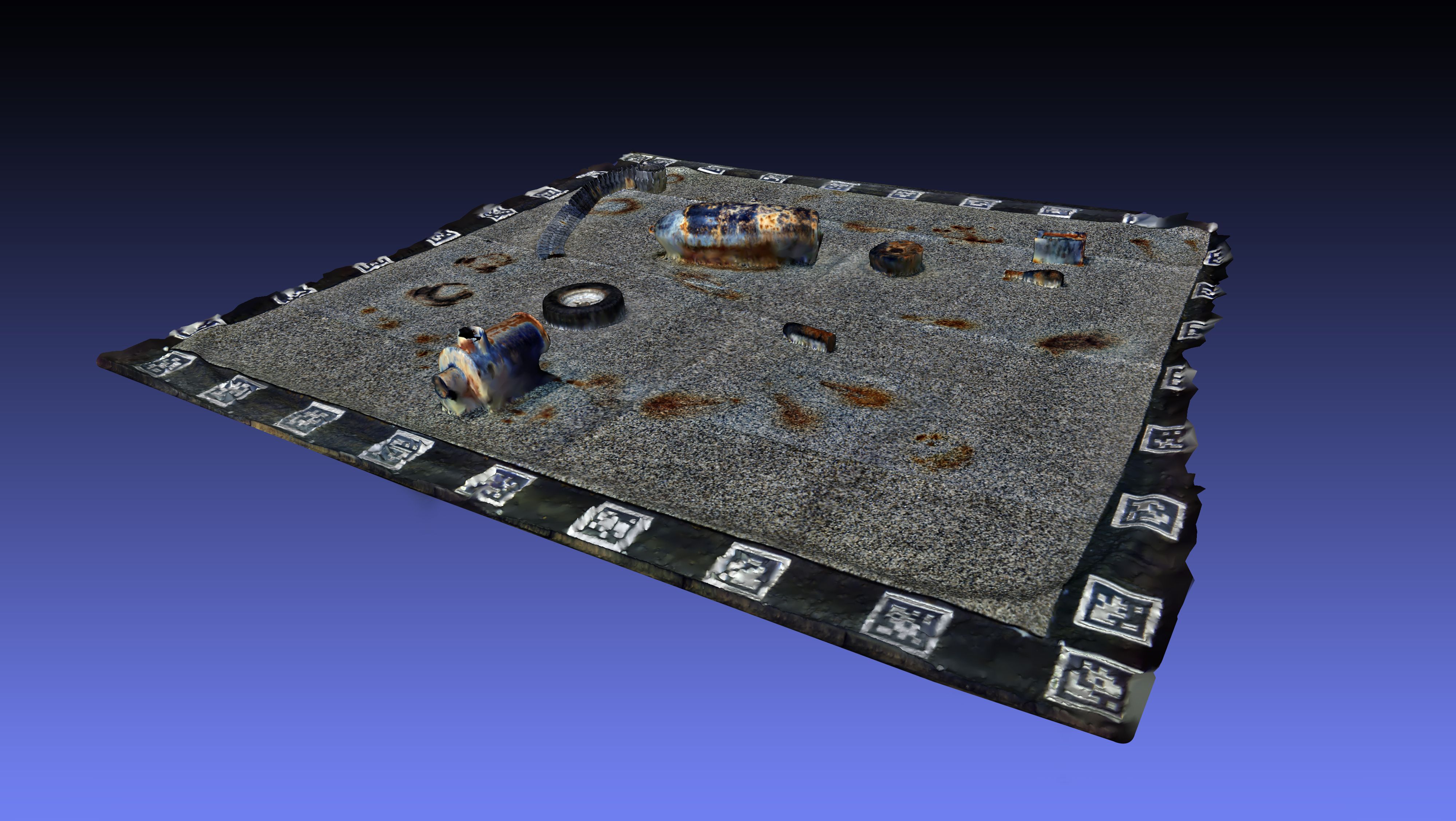

10.11.2025
Enhancing underwater threat detection through hyperspectral imaging
7.11.2025
PlanBlue and Orpheus Ocean join forces to advance sustainable seafloor intelligence into the deep sea
7.10.2025
Bedrock and PlanBlue form strategic alliance to advance high-resolution seafloor intelligence for sustainable ocean infrastructure
Our supporters


Fully-automated seafloor intelligence for smarter maritime surveys.
We made cookies. Would you like some?
We use Google Analytics to improve your website experience and YouTube to show you video content. By clicking "Accept" you are agreeing to the placement and use of cookies as described in our Privacy Policy. Thanks for reading and enjoy your stay on our website.