
Our products
More insight from every deployment
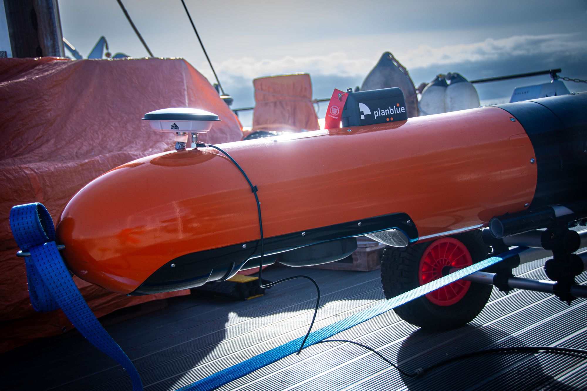
Precise underwater navigation
PlanBlue Payload
Our platform-agnostic payload integrates with AUVs, ROVs, USVs, towed systems, and diver-operated platforms, transforming them into more capable seabed monitoring solutions, without requiring changes to established operational workflows. By augmenting proven platforms with advanced optical sensing, operators see more, capture richer data, and can extract greater value from each deployment.
The payload contains an Underwater Hyperspectral Imaging (UHI) sensor, high-resolution RGB camera, environmental sensors, lights, a computing unit, and motion and navigation systems. This modular configuration delivers precise, geo-referenced datasets while maintaining compatibility with standard vehicle interfaces, mission planning tools, and deployment procedures.


Surveying solution examples with our Payload
AutoRay
This solution is ideal for large-scale projects, enabling high-speed, precise monitoring of extensive seafloor areas and efficiently delivering accurate results across vast distances.

TowRay
Our plug-and-play solution to be towed behind a boat. Ideal for mapping shallow, flat seafloor areas and also well-suited for smaller-scale operations.

DiveRay
A diver-operated solution with an intuitive interface for mission planning and navigation. It enables geo-referenced and consistent and unbiased site monitoring.

Our technology, your benefits.
Fast Time-to-data
Through automation, we reduce analysis time from months or days to just hours, enabling rapid decision-making (and fast intervention).
High Quality Image Recording & Processing
We have overcome numerous technical challenges to deliver crystal-clear results – including water-column correction, which reduces effects such as turbidity that can make images appear milky.
Geo-Referenced Data for Precise Time-Series
Our underwater navigation sensors enable precise site revisits, enhancing project credibility and transparency. We generate time series visualizations to clearly demonstrate the progress and impact of initiatives or construction sites over time.
One Dataset, Endless Insights
Our system captures full spectral and spatial data – no sub-sampling needed. This allows re-analysis anytime, without returning to the field.
Objective Results
Our AI-driven annotation libraries accurately identify seafloor properties, minimizing the need for human intervention both in-field and during analysis, ensuring consistent and objective data.
Multi-level quality control
Our FieldGuide app ensures robust quality control in the field, through map views, video playback, and live GPS tracking – helping prevent redundancy and streamline workflows. Automatic backups and incremental data imports keep operations efficient and secure.
Fully-automated seafloor intelligence for smarter maritime surveys.
We made cookies. Would you like some?
We use Google Analytics to improve your website experience and YouTube to show you video content. By clicking "Accept" you are agreeing to the placement and use of cookies as described in our Privacy Policy. Thanks for reading and enjoy your stay on our website.