
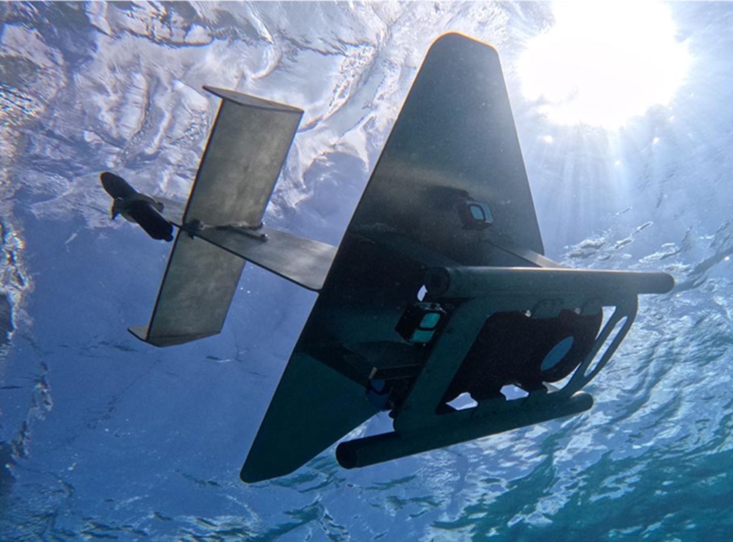
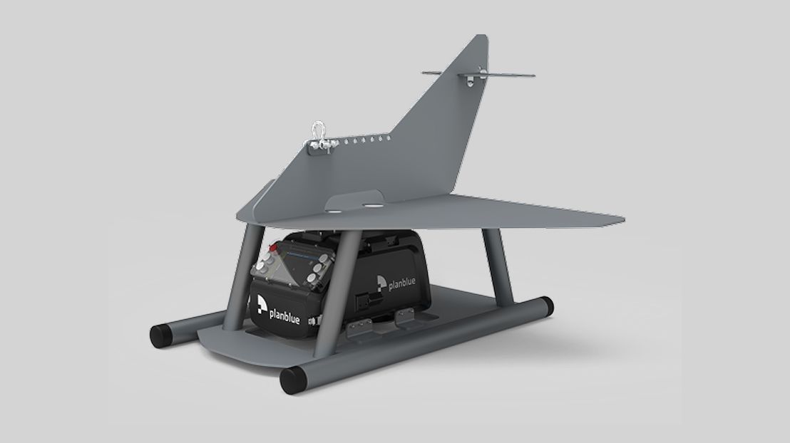
TowRay
The TowRay is a vessel-towed optical imaging system designed to deliver high-resolution RGB and hyperspectral seafloor intelligence in nearshore, shallow-water, and flat seabed environments. Built as a plug-and-play solution, TowRay integrates easily into existing marine survey setups, including underwater wings, towfish configurations, and other vessel-towed survey frames, enabling operators to expand their sensing capabilities without changes to established vessel workflows.


Application
TowRay is ideally suited for large-area seabed mapping and monitoring where efficiency and cost control are critical. Towed behind a small survey vessel, the system allows operators to regulate sensor altitude using a standard winch, like conventional geophysical towfish operations. Real-time data visualization provides immediate feedback during acquisition, enabling optimized coverage, targeted resurveying, and efficient use of vessel time. This makes the TowRay a highly cost-effective solution for repeat surveys, baseline mapping, and time-series monitoring across extensive coastal and shallow-water areas.
The TowRay can be deployed by customer survey teams or delivered as part of turnkey survey services through PlanBlue’s trusted operating partners.
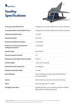
Technical Abstract
- Up to 3kts speed
- Spectral Range 380 - 1000 nm
- Real-time control and monitorin
- Instant data offloading through removable media and offloading to accompanying NAS
- Variable input voltage
- Customizable data interface
- Up to 25 hours of continuous recording
Download TowRay technical specifications sheet
Fully-automated seafloor intelligence for smarter maritime surveys.
We made cookies. Would you like some?
We use Google Analytics to improve your website experience and YouTube to show you video content. By clicking "Accept" you are agreeing to the placement and use of cookies as described in our Privacy Policy. Thanks for reading and enjoy your stay on our website.