News and Stories
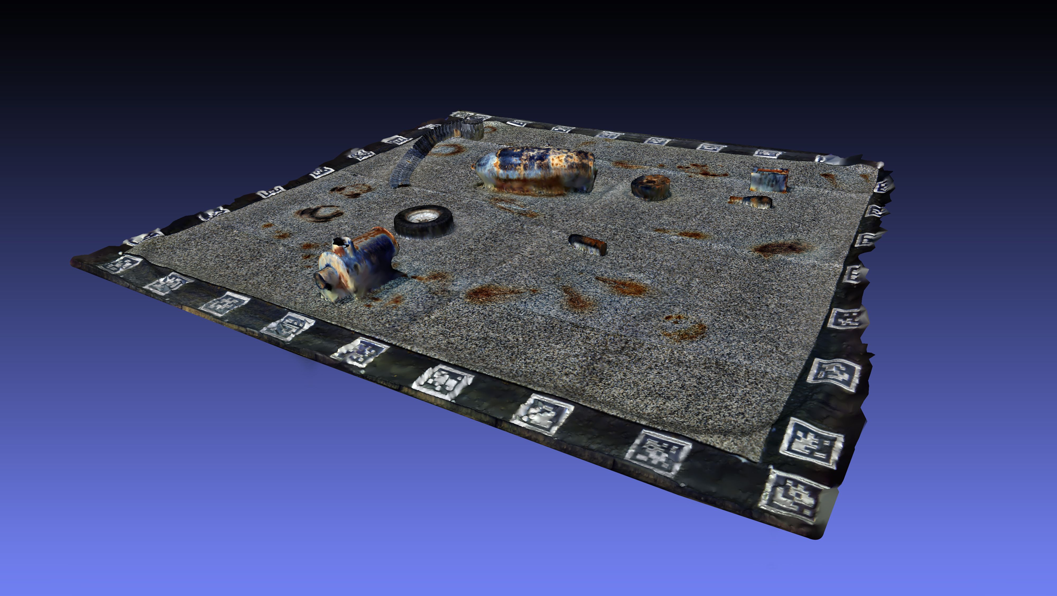
Advancing UXO & MCM Verification with Hyperspectral Intelligence
Following our recent campaign at @DFKI, we’re excited to share an early look at how our hyperspectral data products can support the verification phase in Unexploded Ordnance (UXO) and Mine Countermeasures (MCM) operations.

10.11.2025
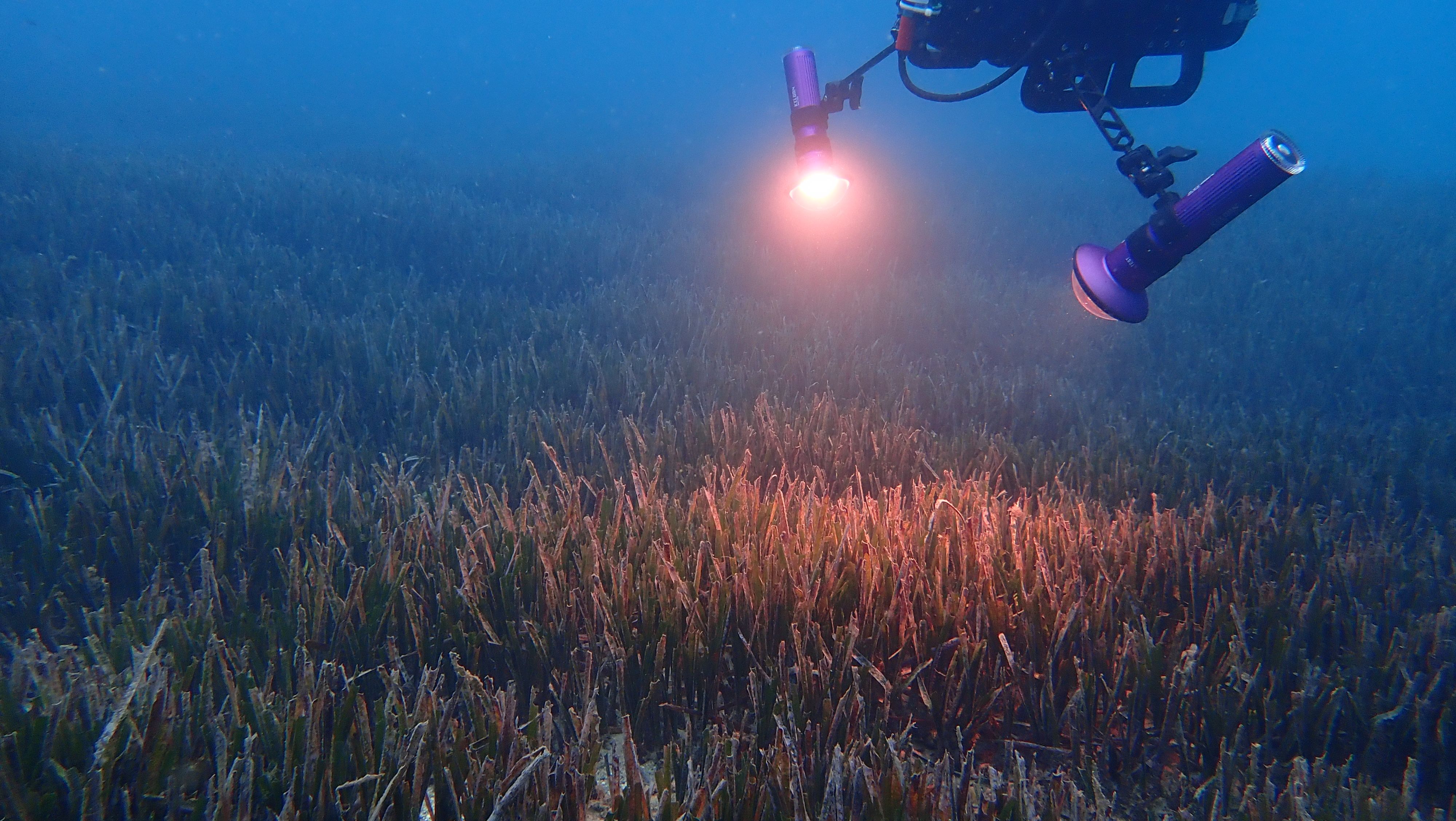
Enhancing underwater threat detection through hyperspectral imaging
PlanBlue is advancing maritime security with its cutting-edge hyperspectral imaging technology to improve close-range verification of unexploded ordnance (UXO) and other underwater anomalies.
7.11.2025
PlanBlue and Orpheus Ocean join forces to advance sustainable seafloor intelligence into the deep sea
7.10.2025
Bedrock and PlanBlue form strategic alliance to advance high-resolution seafloor intelligence for sustainable ocean infrastructure
25.6.2025
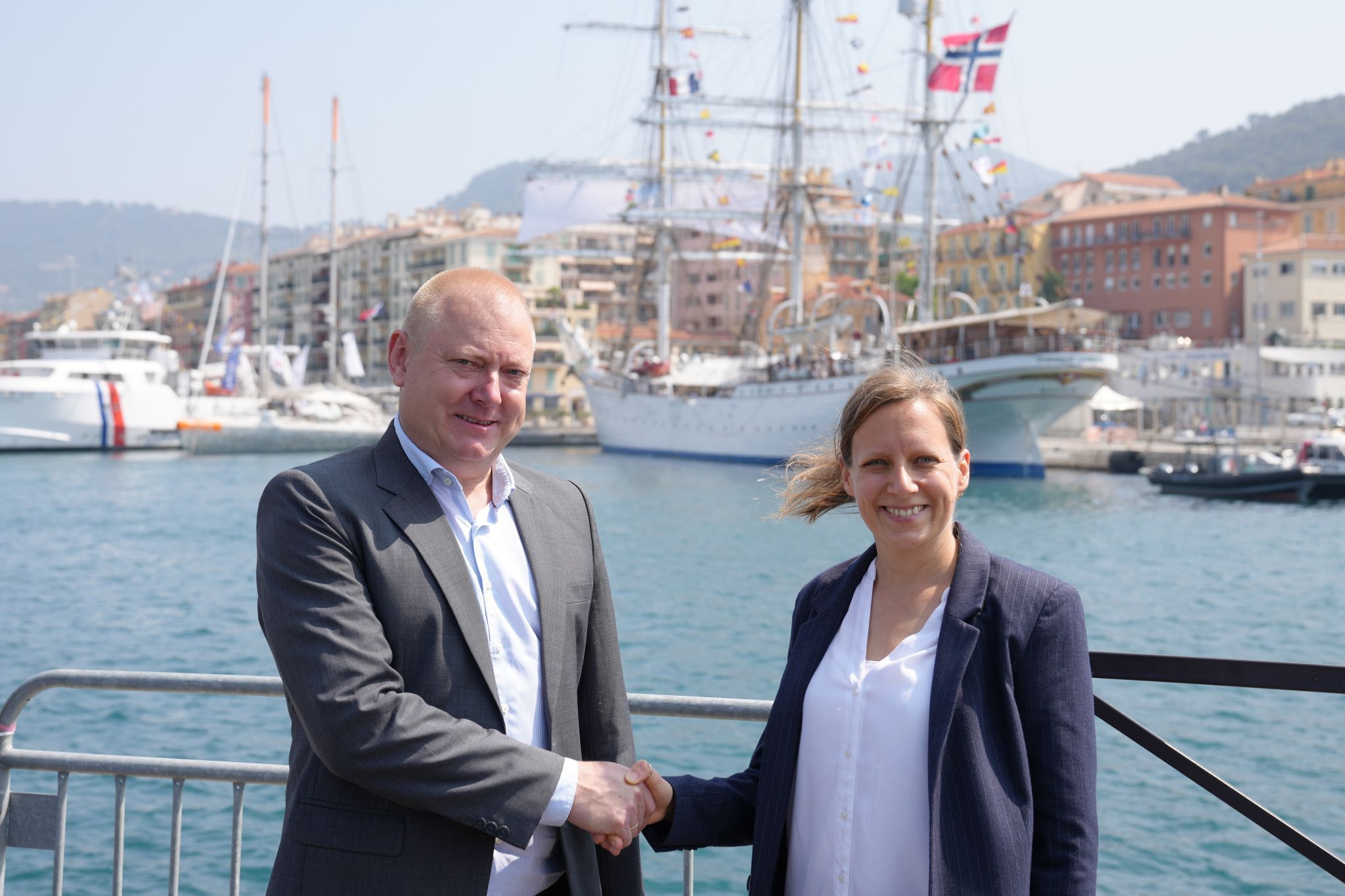
New partnership between DHI and PlanBlue to strengthen ocean health and coastal resilience

7.4.2025
Mapping pollution to enable large-scale restoration
The health of our ecosystems forms the foundation of biodiversity conservation. Without tackling key stressors – such as pollution and habitat degradation – efforts to protect and restore biodiversity will fall short.

1.11.2024
Outcomes from COP16 and Future Contributions from PlanBlue
Reflections from COP16 and PlanBlue’s Future Contributions

24.10.2024
We need radical innovation to deliver on COP16
How advanced imaging and AI can help deliver the Monitoring Framework for the Kunming-Montreal biodiversity agreement

26.9.2024
PlanBlue recognized as leading 'AI for Good' solution by Salesforce

24.6.2024
The Future of Marine Habitat Mapping
Report Launched by European Marine Board for Advancing Seas and Ocean Science.

7.6.2024
Closing the data gap: PlanBlue featured in International Hydrographic Review
Following a passionate talk from our Co-founder and CSO Hannah Brocke at last year’s Hydrographic Conference HYDRO 2023 in Genoa, we got invited to write an article in the International Hydrographic Review.

4.6.2024
Habitat mapping for offshore wind MRV made easy
How hyperspectral imaging and machine learning provide fast and accurate EIA data

24.5.2024
CDL graduation announcement
PlanBlue is proud to announce its graduation from the Creative Destruction Lab (CDL) Melbourne Prime 2023/24 program.
22.3.2024
PlanBlue’s technology increases insights on coral reef transition
PlanBlue’s seafloor habitat mapping technology supported scientific research to monitor coral reef transition in Guam.

7.3.2024
Where to Find Us in 2024
We will be presenting, attending, and tabling at a variety of events throughout 2024, and would love to take the opportunity to connect with you.

1.3.2024
Partnership with Fugro to scale underwater habitat mapping
PlanBlue is excited to announce a groundbreaking partnership with Fugro, world’s leading Geo-data specialist.

1.3.2024
Seagrass - a matter of life or death
Why measuring seagrass health is essential in our fight against climate change.

15.12.2023
PlanBlue measuring performance of artificial reefs
PlanBlue’s seafloor habitat mapping technology was deployed in a study of the Université Côte d'Azur, to assess the effectiveness of artificial reefs to stimulate natural habitats.

7.12.2023
Article published in Scientific Reports assessing PlanBlue’s DiveRay
PlanBlue has published a peer reviewed article on the use of PlanBlue’s DiveRay for reef monitoring in the renowned scientific journal Scientific Reports.

10.10.2023
Seabed 2030 and PlanBlue announce partnership
Seabed 2030 and PlanBlue announce their collaboration in October 2023. The parties will work together to advance our understanding of the ocean floor, and in turn support the global effort underway to map the entire seafloor by 2030.
4.10.2023
From seabed to cloud: PlanBlue featured in Hydro International
Hydro International recently featured an article by our founders Guy Rigot and Raja Kandukuri. Find here a brief overview of the article.

10.9.2023
Where to Find Us in 2023
We will be presenting, attending, and tabling at a variety of events throughout 2023, and would love to take the opportunity to connect with interested stakeholders.

1.3.2023
Happy World Seagrass Day!
Happy World Seagrass Day! Seagrass meadows are one of the most important and overlooked ecosystems on our planet. They provide a vital habitat for a vast array of marine life, from tiny plankton to majestic sea turtles. Not only do seagrass meadows foster biodiversity, they also play a critical role in maintaining ocean health by stabilizing sediments, absorbing carbon dioxide, and producing oxygen.

19.1.2023
Winner of the Ocean Data Challenge
The World Economic Forum's open innovation platform UpLink has selected PlanBlue as one of the winners of its Ocean Data Challenge. This awesome honour is a great support in the journey to scale up.

11.11.2022
High-Quality Blue Carbon Principles
PlanBlue is excited to announce the launch of the High-Quality Blue Carbon Principles and Guidance, a document developed by the Meridian Institute, co-sponsored by Salesforce, World Economic Forum's Friends of Ocean Action, Ocean Risk Allaince, Conservation International and The Nature Conservancy.

24.10.2022
Field Tests for Marine Plastic Detection
After almost a year of work within the MtecPla Project, it was finally time for a field test. PlanBlue took the DiveRay, our underwater satellite monitoring system, to a lake in northern Germany called Hemmoor.

15.6.2022
PlanBlue receives EIC Grant & Geospatial World Award
We know more about Mars than we know about the seafloor. Because flora and fauna play a crucial role for our climate and are a large food and job provider we need innovative technology to monitor their health.

6.4.2022
Hardware Development: DiveRay
High-quality seafloor monitoring requires high-quality gear and we are continuously developing our underwater satellite hardware solution, the DiveRay. The device has gone through numerous iterations and upgrades - on a journey to always become more intuitive for the user and offer a seamless experience of seafloor monitoring.

6.4.2022
Software Development: FieldGuide & SeafloorAtlas
PlanBlue is committed to protect our oceans. By providing easy-to-understand seafloor maps we enable decision makers to find solutions for global problems, such as climate change, biodiversity loss and pollution.

5.4.2022
Taking the next step with our underwater navigation technology
After a couple of months fine-tuning our hard- and software in our labs and home-offices we now finally had the chance to test our technology again in the water before preparing for the next mapping campaign.

15.7.2021
Underwater Hackathon 2021
After spending much of 2021 in the home office, our team decided to plan its very first hackathon with the aim to work on our process from data acquisition to data analysis. This was the first time in 2021 that the whole team saw each other in a long time without the help of technology – to say we were excited is a bit of an understatement.

22.6.2021
Pool Tests for Marine Plastic Detection
After half a year of development and planning within the MtecPla Project, we were excited to finally test the capabilities of our detection systems with specially prepared sediment plastic mixtures under controlled laboratory conditions.

23.11.2020
Project Start 'MtecPla'
In the research project ‘MtecPla’, planblue, together with the University of Stuttgart, the German Research Center for Artificial Intelligence (DFKI) and Kurt Synowzik Werkzeug u. Maschinenbau (KSW), is advancing its technology further and taking marine litter monitoring to the next level.

15.9.2020
Technology Demo - Portugal, Sept. 2020
We are very excited to officially announce our technology demo in Cascais, Portugal in September 2020. Together with our partners Municipality of Cascais and SeaForester we will host several

7.2.2020
Joost at TEDx Bremerhaven
Our CEO Joost den Haan gave a TEDx Talk recently and it is now online. Go check it out to find out more about his passion for the seafloor and why he believes that studying and understanding it is crucial to change the way we interact with the underwater world.

15.11.2019
Return to the University of Guam (NASA EPSCoR)
In November 2019, our CTO Guy returned to the island of Guam in the Western Pacific. Together with Prof. Tom Schils and his team, Guy monitored the island’s coral reefs with the new and improved planblue technology.

26.11.2018
University of Guam (NASA Geocore)
In September 2018, Joost visited the island of Guam (USA). Together with Prof. Tom Schils from the University of Guam, he scanned coral reefs using the PlanBlue technology. This project was executed as part of the NASA Geocore program.

23.7.2018
Seafloor restoration in Southern France
In July 2018, we monitored seafloor restoration efforts in Monaco / Southern France, together with the University of Nice Sophia Antipolis and AMPN. This project is supported by the Prince Albert II of Monaco Foundation. Follow-up projects are scheduled early 2020.
Fully-automated seafloor intelligence for smarter maritime surveys.
We made cookies. Would you like some?
We use Google Analytics to improve your website experience and YouTube to show you video content. By clicking "Accept" you are agreeing to the placement and use of cookies as described in our Privacy Policy. Thanks for reading and enjoy your stay on our website.